ESdat Online
ESdat Online offers a highly interactive and intuitive experience for users looking to manage and report their laboratory, field, borehole, data logger and related environmental or scientific data.
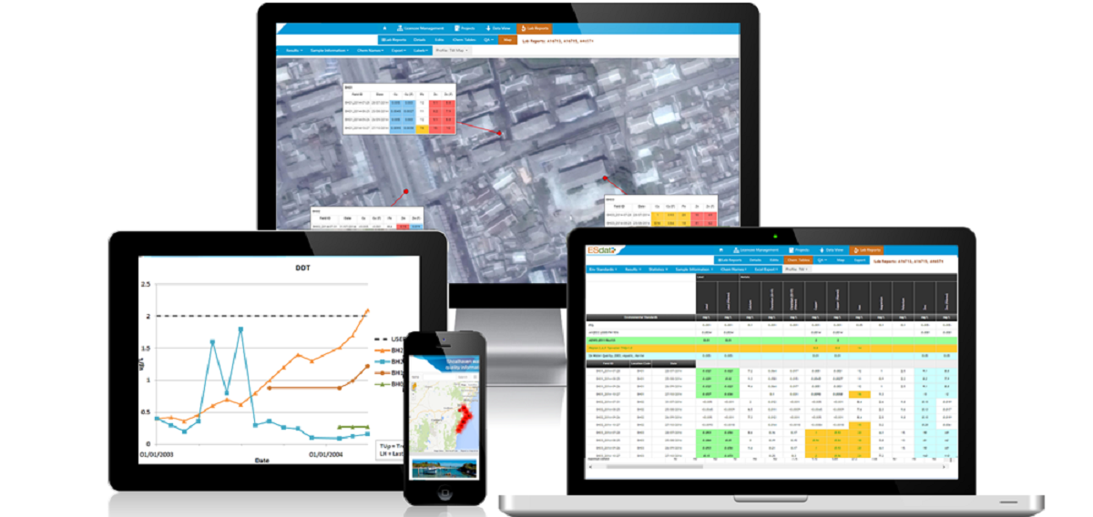
The web interface is simple enough that most users can use it immediately with no training or familiarization.
Regulatory Environmental Standards Pre-Loaded
USA, Canadian, Australian, NZ, UK and other Regulatory Environmental Standards pre-loaded and up to date.
- Add your own Environmental Standards as needed
- pH / Hardness / depth & matrix dependances supported
- Receive an email notification whenever an exceedance is encountered.
Laboratory Results
Laboratory Results are automatically uploaded into ESdat from supporting laboratories using the LabSync validation and import mechanism. Laboratory onboarding and any troubleshooting is performed by LabSync support in conjunction with the Laboratory.
- Results can be automatically uploaded by most laboratories
- Store and access all your data from multiple laboratories in one location
- Certified PDF copies of the laboratory report are retained
- Receive an email notification whenever a Lab Report is uploaded, with a link direct to your data
- Notifications of exceedances are emailed directly to users.
Exceedance Tables
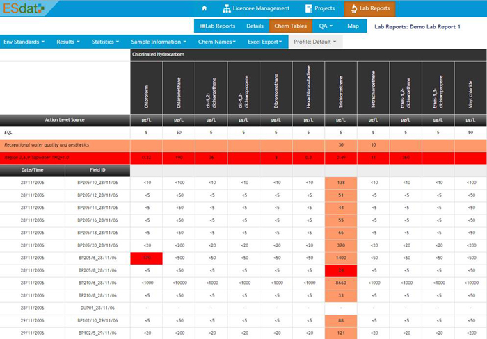
Chemistry Summary tables such as below, show analytical results compared against Environmental Standards. Data can be filtered by Laboratory Report, Location, Date Range or a variety of other options.
 Watch video on YouTube
Interactively apply different Environmental Standards, view Detects or Exceedances Only; enter qualifiers or comments; adjust the layout, analytes, naming, units and more. Table settings can be saved and reused. Tables can be exported to Excel/PDF for use in reports.
Maps
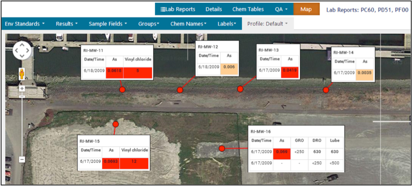
Chemistry results can be displayed in call-out-tables with Exceedances highlighted. An example map display is below.
The locations can be exported to other packages such as ArcGIS, MapInfo, QGIS or other GIS packages. The formatted call-out-tables can be exported in png format and positioned to fit.
 Watch video on YouTube
ESdat uses Bing Maps imagery as the default background for built in mapping features. Users can also add Map Layouts utilising WMS (web mapping service) or WFS (web feature service) layers. There are an increasing variety of government and other WMS and WFS layers available online.
Graphs
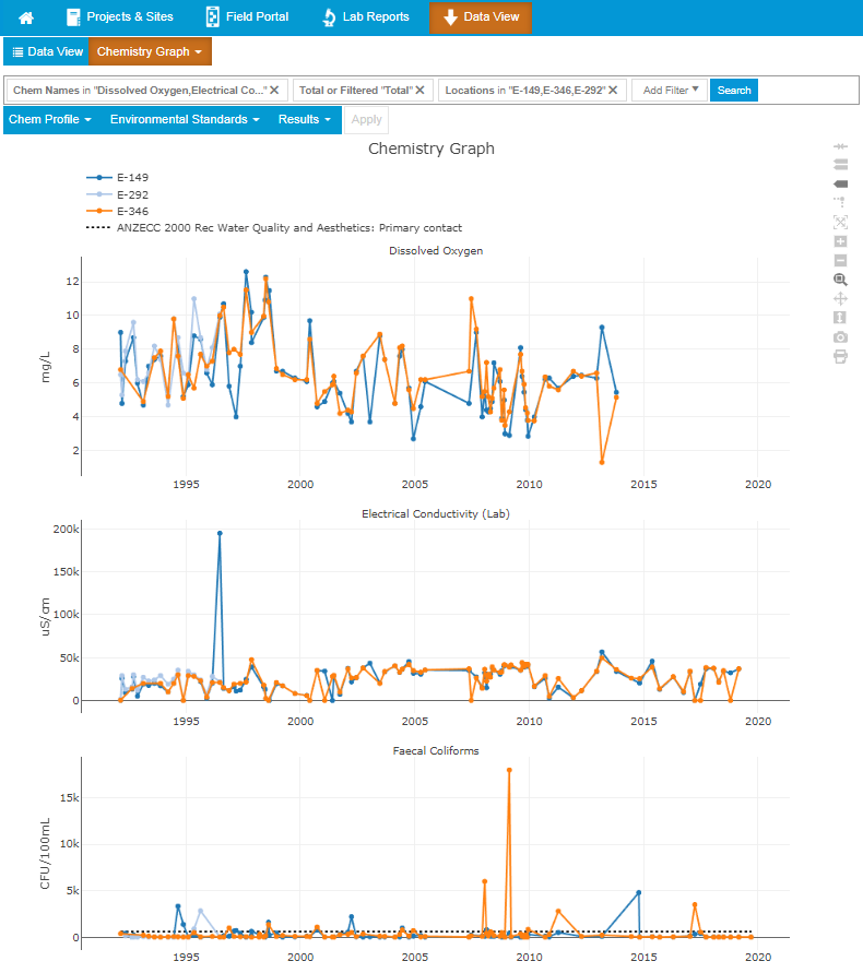
Results can be filtered by Location, Parameter or a variety of other options and viewed as time series charts.
QA
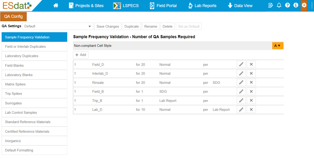
QA Reports on your field and laboratory data provide confidence in the results. QA checks include Field Duplicates (RPD Values), Lab Duplicates, Spikes, Surrogates, Blanks and various logic checks.
Field App
The ESdat Field App runs on any PC, Tablet or a Phone. It works offline and can be used ad-hoc or combined with LSPECS for scheduling field programs.
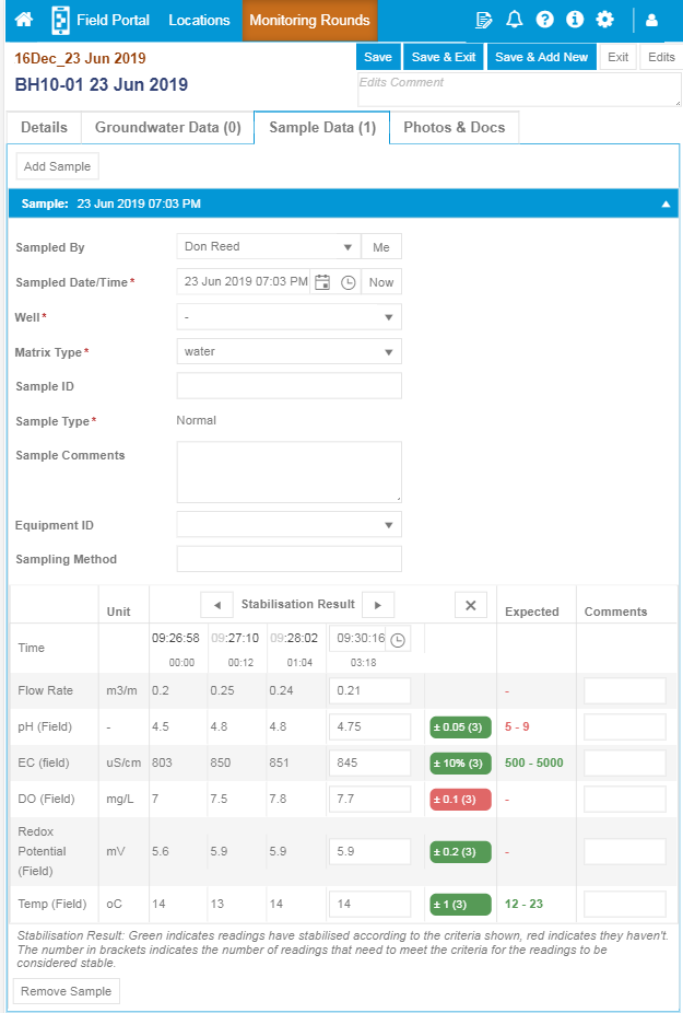
Field Results are entered using the form below, which can be configured to meet custom requirements and records all information and results related to a visit to a Location.
 Watch video on YouTube
The ESdat Field App on a tablet with stabilisation indicated as red or green
The ESdat Field App is complemented by the Locations Portal which shows all your Monitoring Locations, can calculate their distance from you, and shows associated details, photographs, documents and previous monitoring results.
Logger Data
Extendable
ESdat Online and ESdat Server can report data live as public portals, API's, custom reports and other options.
Request a Demo Account