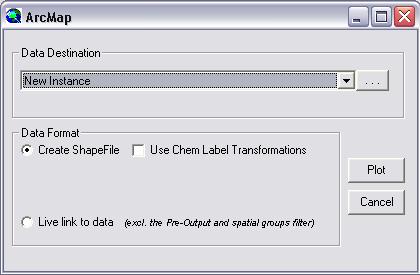
Data viewed through ESdat can be exported and viewed in ArcMap as a shapefile, or via a live ODBC link to the data.

The data can be viewed in any ArcMap project. When exporting chemistry data the user is able to specify that Chemical Label transformations be used. This restructures chemical data upon output so that the labels are stacked, in a similar way to the labelling that is shown in the internal ESdat map.
Using a live ODBC link to the data doesn't allow automated label stacking, but you can write your own scripts in ArcGIS and the data will always represent the actual contents of the database (as opposed to exporting a static Shape file which will not change)
The automatic display in ArcMap can be edited by using the template files "ArcGIS_Template.mxd", and "ArcGIS_ChemLabel_Template.mxd" for non-stacked and stacked labels respectively.